Map
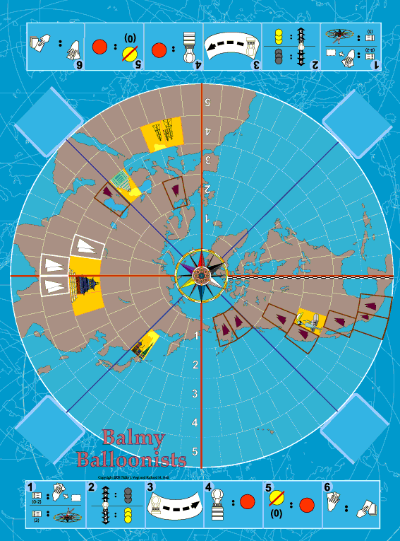
The game is played on a polar stereographic view of the northern hemisphere. The main balloon tracks are indicated by latitude bands, essentially, race track lanes around the globe. Between 64 degrees North latitude and 15 degrees North latitude are the main jet locations so there are five "lanes" numbered 1-5. Red longitude lines on the polar view are used to divide the map into four 90 degree regions called Quadrants.The red longitude line running through North America also serves as the start and finish line for all balloons, at least in the main game, although there are rules for many other races as well.
Lanes are further divided by vertical lines to form spaces.
The yellow colored spaces represent Exclusion Zones over which special flying conditions obtain. Each depicts a special image which is related to the corresponding nation. Each image is linked to an Advantage card which confers a special flying privilege.

At either end of the board is shown the sequence which each player follows during his turn. This pictorial version is designed to be understood by speakers of any language. At the corners, card ports hold the Quadrant cards which show the current weather for that segment of the map.
At the pole is the wind rose. Its six colors match those of the balloons to have a dramatic effect on play.
Not shown is the storm tile, a dangerous moving obstacle for daring balloonists.